Share
An integrated surface and groundwater model to analyze flow and transport patterns within the watershed using an integrated MIKE SHE, MIKE 11, and MIKE URBAN model to couple the drainage system with surface and subsurface domains. Developed a GIS database supporting model development using ArcGIS Server 9.3 with ArcSDE/SQL Server for storage and retrieval of hydrological data, gridded and station based rainfall and evapotranspiration, groundwater tables, moisture content.
Development of an integrated surface and groundwater model to study the multiphase transport of mercury species in the saturated and variably saturated zones of the White Oak Creek (WOC) watershed, including physical, biological and chemical transformations under site-specific environmental conditions.
The project utilized the MIKE SHE/11 hydrological modeling software by DHI Water & Environment Inc. with integrated geographic information systems (GIS) data input to analyze the entire hydrological cycle and predict mercury fate and transport in the WOC watershed.
Laboratory tests were conducted to determine mercury transport and adsorption/desorption (Kd) parameters in ORR soil to support model de velopment via the use of experimentally determined input values.
Prediction of mercury fate and transport in soil and groundwater under varying environmental conditions was accomplished and better understanding of the mercury speciation, transport parameters and distribution in different phases, which will provide more accurate estimates of the risks associated with D&D operations.
The project provided a tool for “what if” analyses and lowering uncertainties and considerably better spatial and temporal forecasting of the mercury contamination and for reducing cleanup costs and accelerating cleanup schedule.


If you have a comment, we want to know.
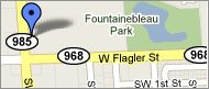
Applied Research Center at
Florida International
University
10555 W. Flagler Street
Suite 2100
Miami, FL 33174
Tel: 305-348-4238
Fax:
305-348-1852
M-F (8:30 am to 5:00 pm)