Research Areas and Capabilities
Research Areas
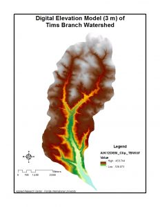
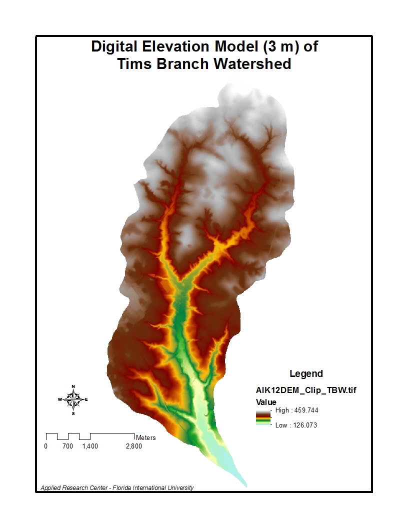
Digital Elevation Model (3 m) of Tims Branch Watershed
integrated surface and groundwater modeling
- water quality modeling
- nutrient, chemical and radioactive contaminant fate and transport modeling
- soil and groundwater remediation
- environmental assessment
- land and water resources management
- assessment of renewable energy resources
- assessment and impacts of land use change
- climate change analysis
- air dispersion modeling
- storm water modeling
Capabilities
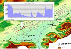
Geographic Information System (GIS)
2-D & 3-D mapping, visualization and geospatial analysis using the latest ArcGIS platform
- delineation of geographic features
- geodatabase development
- development and implementation of process flow models using ArcGIS ModelBuilder and Python scripting
- geospatial data and metadata development
- internet and mobile application development
- development of GIS-enabled remote monitoring systems
- conversion of computer-aided design and drafting (CADD) data
- development of waste information management systems applications

Collaborators
- Savannah River National Laboratory (SRNL)
- Oak Ridge National Laboratory (ORNL)
- Pro2Serve Professional Project Services, Inc.
- Cabrera Services, Inc.
Publications
Peer-reviewed Publications
- Malek-Mohammadi, S., Tachiev, G., Cabrejo, E., and Lawrence, A. (2012). Simulation of flow and mercury transport in Upper East Fork Poplar Creek, Oak Ridge, Tennessee. Remediation, 22(2), 119–131.
Conference Presentations
- Lawrence, A., Tachiev, G, Utilization of GIS Technology to Support Development of Flow and Contaminant Fate and Transport Models at US DOE Sites. Waste Management 2015 Conference, Phoenix, AZ, March 2015 (paper and poster).
- Lawrence, A., M. Mahmoudi, S. Setegn, N. Duque, A. Rana, Using GIS for Processing, Analysis and Visualization of Hydrological Model Data. Waste Management 2016 Conference, Phoenix, AZ, March 6-10, 2016 (paper and poster 16202).
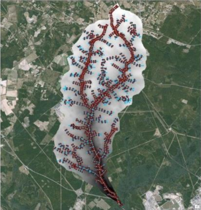
- Mahmoudi, M., A .Lawrence, S. Setegn, N. Duque, B. Looney. Development of an Integrated Hydrological Model for Simulation of Surface Runoff and Stream Flow in Tims Branch Watershed. Waste Management 2016 Conference, Phoenix, AZ, March 2016 (paper and poster).
- Strand, C. (DOE Fellow), Topographic Analysis to Support the Hydrology Model of the Tims Branch Watershed, Aiken, SC, Waste Management 2016 Conference, Phoenix, AZ, March 6-10, 2016 (poster 16202).
- Lawrence, A., M. Mahmoudi, S. Setegn, 2015. GIS as an Integration Tool for Hydrologic Modeling: Spatial Data Management, Analysis and Visualization, 2015 AGU Fall Meeting, 14-18 December 2015 (poster H13C-1557).
- Mahmoudi, M., A .Lawrence, S. Setegn, N. Duque, 2015. Integrated Modeling System for Analysis of Watershed Water Balance: A Case Study in the Tims Branch Watershed, South Carolina, 2015 AGU Fall Meeting, 14-18 December 2015 (poster H13C-1558).
- Siamak Malek-Mohammadi*, Georgio Tachiev*, David Roelant*, Reinaldo Garcia-Martinez*, Amy Cook*, Elsa Cabrejo*, Kent Bostick** Anamary Daniel** Numerical Simulation of Mercury Fate and Transport in Upper East Fork Poplar Creek, Oak Ridge, TN. Waste Management 2011 Conference, Phoenix, AZ, March 6-10, 2011.
Infrastructure
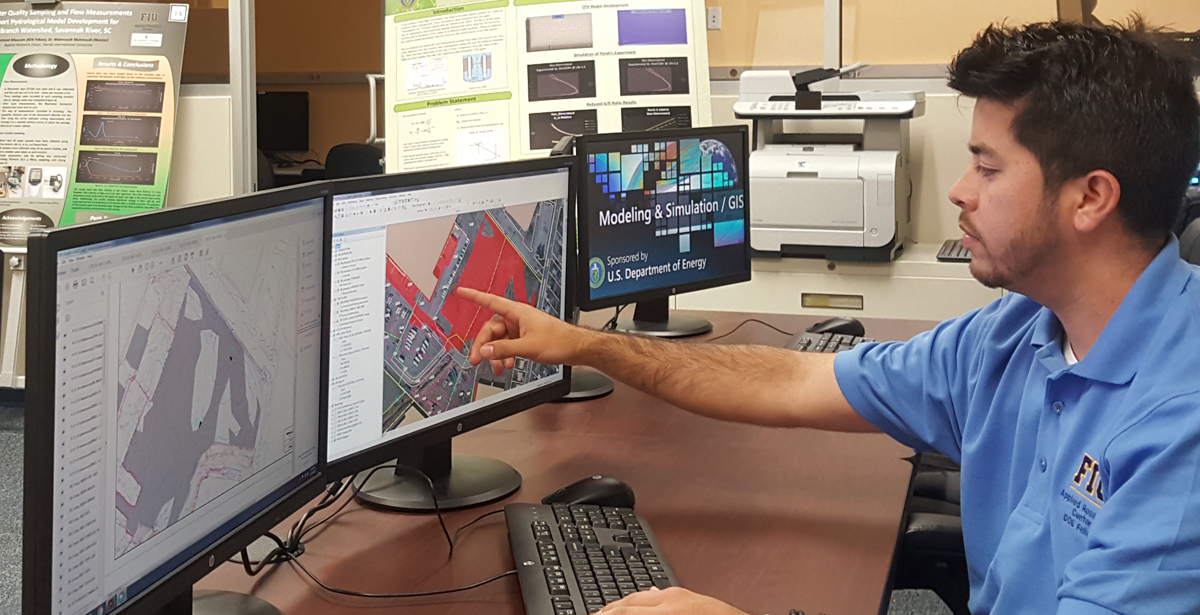
Modeling, Simulation & GIS Research Laboratory
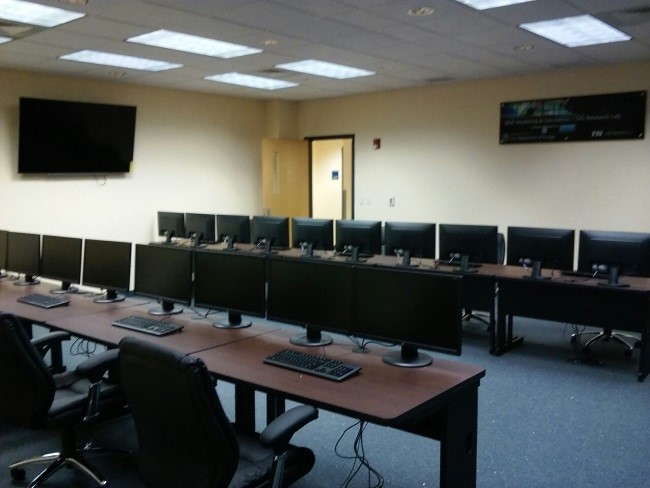
Modeling, Simulation & GIS Research Laboratory
This ARC laboratory is a top-tier, state-of-the-art facility located at FIU’s Engineering Campus. Research conducted in the laboratory is focused on geospatial, hydrological, hydrodynamic and water quality modeling; development of information systems for land and water resources management; geochemical speciation of contaminants and modeling of reactive transport; modeling of computational fluid dynamics; heat transfer and thermal modeling. The lab is fully equipped with computers that have hydrological and hydrodynamic models, GIS and remote sensing software, climate change downscaling tools and models, thermodynamic speciation models, solute transport models, CFD models, statistical software, programming languages and other necessary software that support FIU staff, students and faculty in implementation of FIU ARC’s modeling, simulation & geographic information systems (GIS) research and development activities
Photos


")