Research Areas and Capabilities
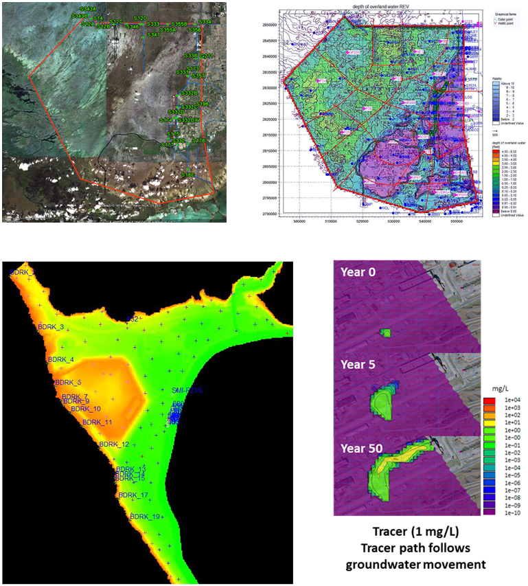
Tracer groundwater movement
ARC’s goal is to develop best available data and water balance products using numerical methods and data collection. The water resources research group works closely with research associates, faculties, and students worldwide. Current research focuses on United State Department of Energy sites and involves development of numerical tools to simulate past, present, and future hydrological scenarios in local and regional scales. In addition, ARC’s expertise in sampling and monitoring water quality provides a practical training ground for undergraduate and graduate students at FIU. ARC’s water resources research interests also extend to national and global-scale model development, hydrologic information systems, remote sensing, and data assimilation. Students working with ARC water resources research group benefit from exposure to multiple disciplines, giving them a broad foundation for understanding complex environmental issues.
Research Areas
- integrated surface and groundwater modeling
- water quality modeling
- contaminant fate and transport modeling
- land and water resources management
- climate change analysis
- storm water modeling
Capabilities
ARC water resources research is focused broadly on developing numerical tools that can be used to monitor, assess, and evaluate water quality and hydrological changes in the environment using various commercial and non-commercial hydrology software that are approved by federal and state agencies. Our areas of expertise include:
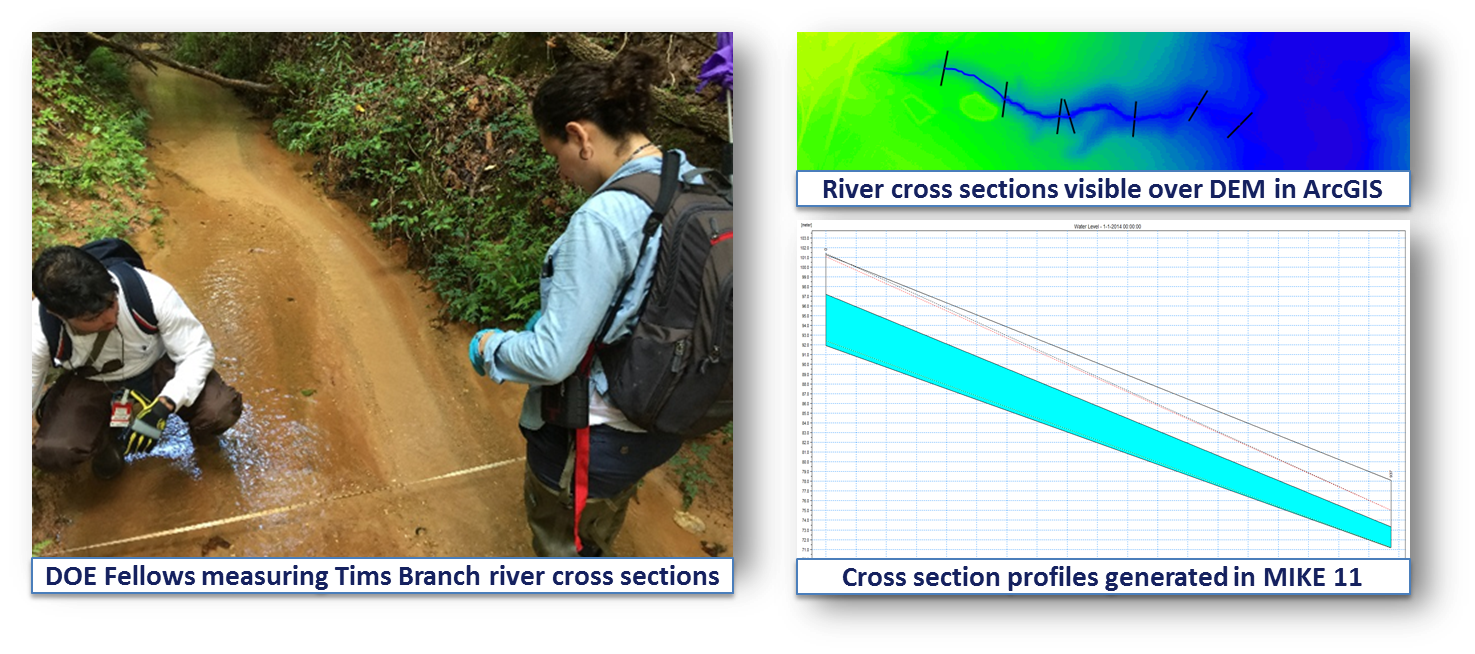
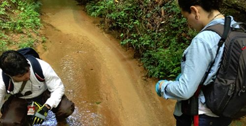
Collection of in-situ field data to support hydrological model development
- Flood simulation
- Fate and transport modeling
- Hydrogeology studies
- Water quality monitoring
- Pollution studies
- Wetland hydrology
Collaborators
- Savannah River National Lab (SRNL), US Department of Energy
- Savannah River Ecology Lab (SREL), University of Georgia
- Oak Ridge National Lab (ORNL), US Department of Energy
- National Park Services, US Department of Interior
- Army Corp of Engineers
- Department of Earth and Environment, College of Arts and Science, FIU
- Department of Civil and Environmental Engineering, College of Engineering, FIU
- Southeast Environmental Research Center, FIU
Publications
Peer-reviewed Publications
- Malek-Mohammadi, S., Tachiev, G., Cabrejo, E., and Lawrence, A. (2012). Simulation of flow and mercury transport in Upper East Fork Poplar Creek, Oak Ridge, Tennessee. Remediation, 22(2), 119–131.
Conference Presentations
- Lawrence, A., Tachiev, G, Utilization of GIS Technology to Support Development of Flow and Contaminant Fate and Transport Models at US DOE Sites. Waste Management 2015 Conference, Phoenix, AZ, March 2015 (paper and poster).
- Lawrence, A., M. Mahmoudi, S. Setegn, N. Duque, A. Rana, Using GIS for Processing, Analysis and Visualization of Hydrological Model Data. Waste Management 2016 Conference, Phoenix, AZ, March 6-10, 2016 (paper and poster 16202).
- Mahmoudi, M., A .Lawrence, S. Setegn, N. Duque, B. Looney. Development of an Integrated Hydrological Model for Simulation of Surface Runoff and Stream Flow in Tims Branch Watershed. Waste Management 2016 Conference, Phoenix, AZ, March 2016 (paper and poster).
- Lawrence, A., M. Mahmoudi, S. Setegn, 2015. GIS as an Integration Tool for Hydrologic Modeling: Spatial Data Management, Analysis and Visualization, 2015 AGU Fall Meeting, 14-18 December 2015 (poster H13C-1557).
- Mahmoudi, M., A .Lawrence, S. Setegn, N. Duque, 2015. Integrated Modeling System for Analysis of Watershed Water Balance: A Case Study in the Tims Branch Watershed, South Carolina, 2015 AGU Fall Meeting, 14-18 December 2015 (poster H13C-1558).
- Siamak Malek-Mohammadi*, Georgio Tachiev*, David Roelant*, Reinaldo Garcia-Martinez*, Amy Cook*, Elsa Cabrejo*, Kent Bostick** Anamary Daniel** Numerical Simulation of Mercury Fate and Transport in Upper East Fork Poplar Creek, Oak Ridge, TN. Waste Management 2011 Conference, Phoenix, AZ, March 6-10, 2011.
Infrastructure
Modeling, Simulation & GIS Research Laboratory
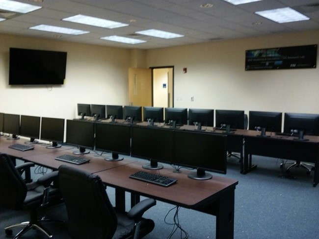
Modeling, Simulation & GIS Research Laboratory
This ARC laboratory is a top-tier, state-of-the-art facility located at FIU’s Engineering Campus. Research conducted in the laboratory is focused on geospatial, hydrological, hydrodynamic and water quality modeling; development of information systems for land and water resources management; geochemical speciation of contaminants and modeling of reactive transport; modeling of computational fluid dynamics; heat transfer and thermal modeling. The lab is fully equipped with computers that have hydrological and hydrodynamic models, GIS and remote sensing software, climate change downscaling tools and models, thermodynamic speciation models, solute transport models, CFD models, statistical software, programming languages and other necessary software that support FIU staff, students and faculty in implementation of FIU ARC’s modeling, simulation & geographic information systems (GIS) research and development activities
Photos